Application Description
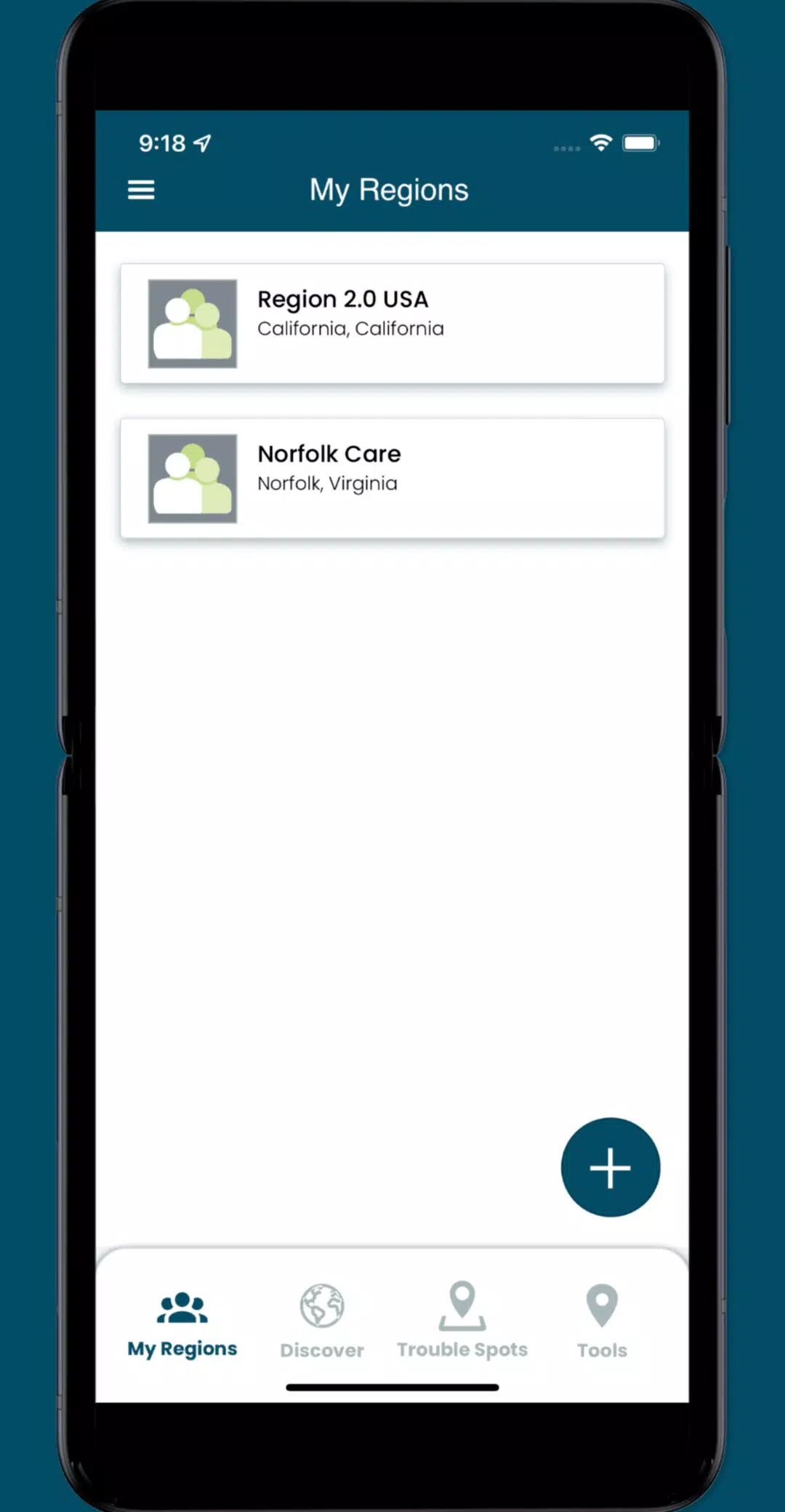
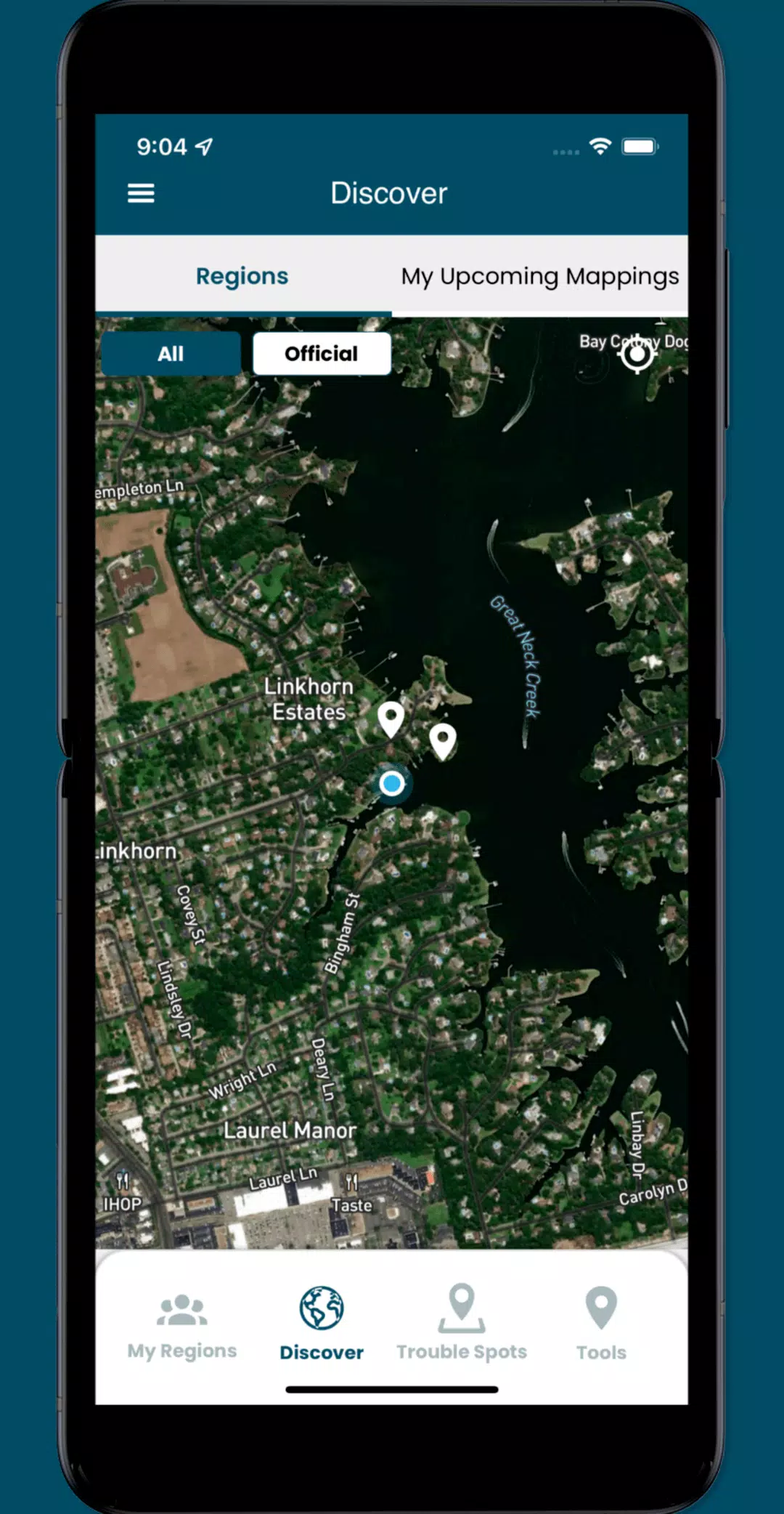
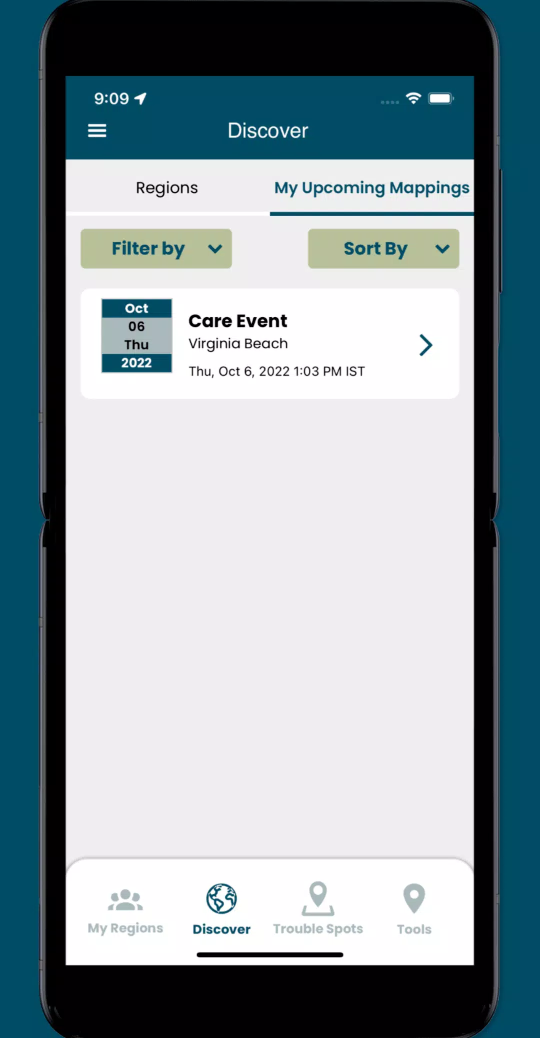
Join the fight against sea level rise by participating in crowd-sourcing events with the Sea Level Rise app. This innovative tool empowers you to map flooding in your community, documenting the impacts of sea level rise and other flooding events. Designed for everyone in low-lying coastal regions, the app was initially developed in Hampton Roads, Virginia, where it has benefited from the mapping efforts of thousands of volunteers during annual "Catch the King Tide" events. Created by Wetlands Watch, this app fosters a better-informed and more connected community, enabling us to proactively address the challenges posed by rising sea levels.
By using the Sea Level Rise app, you can access user-submitted data on this global phenomenon and volunteer to capture vital street-level information. This data is crucial for researchers and civic leaders to better understand and tackle the challenges brought by sea level rise. Here's what you can do with the app:
- Participate in crowd-sourcing events to gather the localized data that researchers and civic leaders need but often lack.
- Identify and report "Trouble" spots where high water impacts your travel during inclement weather.
- Capture and share photos to document the flooding occurrences in your community.
- Engage with specific collaboration spaces, called regions, to manage volunteers and schedule mapping events effectively.
What's New in the Latest Version 3.0.9
Last updated on Oct 19, 2024
Update the following functionality:
- Implemented minor UI enhancements and resolved several issues throughout the app.
Screenshot

Reviews
Post Comments
Latest Articles
Yōtei Ghost Cinematic Filters Customize Game Vibe
Ghost of Yōtei is designed to evoke the feel of classic samurai cinema through its in-game visual filters and modes, offering a deeply immersive atmosphere. Continue reading to learn more about how the game creates a vivid, cinematic adventure.Ghost
MTG's Edge of Eternities Sold Out at Amazon on Launch
Magic: The Gathering enthusiasts have been counting down to their journey through the Blind Eternities, and the moment has finally arrived. Edge of Eternities officially launched worldwide today, bringing cosmic-scale fantasy to the classic trading c
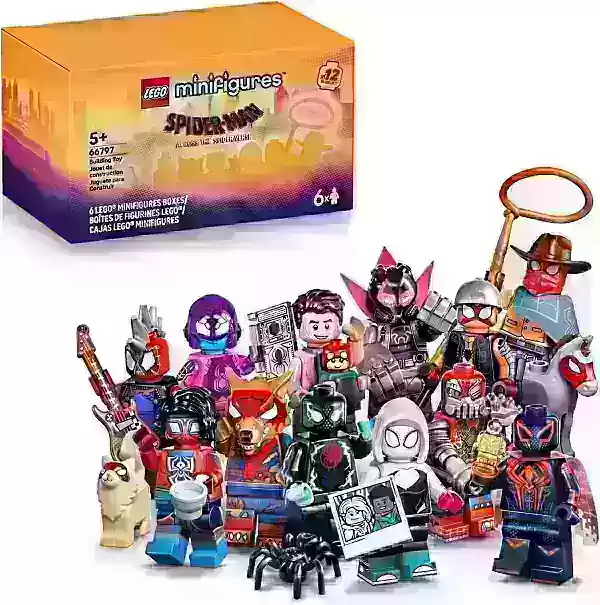
LEGO Spider-Verse Minifigures Available for Preorder
LEGO is launching an exciting array of new sets this season, but if you're only looking to expand your minifigure collection, the company has a pleasant surprise in store next month. Starting September 1, LEGO will release a blind box of Spider-Man:
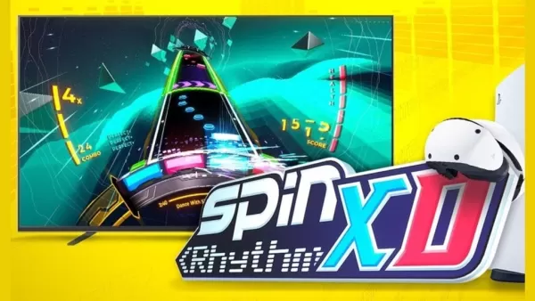
Spin Rhythm XD Is Coming to Mobile Soon on the Crunchyroll Game Vault
You may know developer Super Spin Digital for titles like Fruit Ninja, Jetpack Joyride, and Steppy Pants. Another one of their popular releases is the rhythm game Spin Rhythm, whose success paved the way for its sequel, Spin Rhythm XD, which launched

Elden Ring Glitch Eases Item Sharing in Nightreign
Elden Ring Nightreign features some incredible gear drops. There may even be times when you wish to share this equipment with others, while still keeping it for yourself. Fortunately, a gear duplication glitch makes sharing this loot possible, at lea
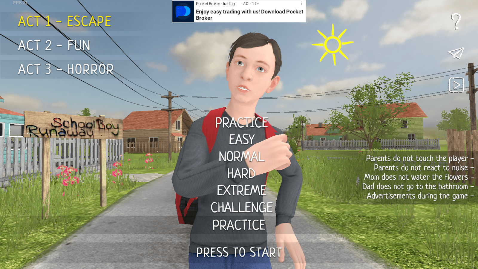
Master Stealth Tactics in SCHOOLBOY RUNAWAY
SCHOOLBOY RUNAWAY – STEALTH delivers thrilling stealth gameplay where you play as a mischievous student who'd rather sneak out than hit the books. Carefully evade your watchful parents using clever tactics and everyday household items to execute your
Apps like Sea Level Rise

Meteoprog - Weather forecast
Weather丨28.0 MB

My Moon Phase
Weather丨43.9 MB
Rain Today
Weather丨97.3 MB

Rome Weather Forecast
Weather丨28.4 MB

Buienradar
Weather丨65.4 MB
WDTN Weather
Weather丨51.7 MB

Weatherzone
Weather丨92.6 MB

Latest Apps

Учи.ру 0–4 класс
Education丨12.8 MB

에스크 asked
Communication丨18.30M


Spiga+ AI
Auto & Vehicles丨12.0 MB


Epoxy Resin Art Ideas
Art & Design丨41.0 MB

Lola Casademunt
Shopping丨6.8 MB

Anime Chicken
Tools丨38.90M

WashAssist Dashboard
Lifestyle丨11.70M
Trending Apps
MORE +


Top News
MORE +

01
01-06
CDPR acknowledged weak gameplay in The Witcher 3
The Witcher 3, while critically acclaimed, wasn't without its flaws. Many fans felt the combat system fell short.
In a recent interview, Witcher 4's game director, Sebastian Kalemba, acknowledged weaknesses in the previous game's gameplay, specifically highlighting the need for significant improvem
02
01-07
BREAKING: Flight Simulator 2024 Login Woes Ground Players
Flight Simulator 2024 Launch Plagued by Technical Difficulties
The highly anticipated launch of Flight Simulator 2024 has been significantly hampered by widespread technical problems, leaving many players grounded before they could even take to the virtual skies. This article details the reported d
03
11-17
Hogwarts Legacy 2 is "One of the Biggest Priorities" for WB Games
Following the successful launch of Quidditch Champions this week, Warner Bros. Discovery has confirmed its plans for a sequel to last year's Harry Potter-based action RPG hit Hogwarts Legacy—2023's best-selling game.Hogwarts Legacy Sequel Plans Confirmed by Warner Bros. DiscoveryExpected in
04
11-16
Airplane Chefs Brings The Ultimate Snack, Pringles, On Board!
Buckle up for some snacks as Nordcurrent has just dropped an exciting event for their cooking game. It’s the most unexpected collab of Airplane Chefs and Pringles. If you’ve been enjoying your virtual life as a flight attendant, things are about to get a lot tastier.The game developer behind p
05
11-16
Play Together to collaborate with Sanrio and introduce new My Melody and Kuromi content
Play Together is bringing back its Sanrio collab with the appearance of My Melody and KuromiYou can collect coins by completing their themed missions that can then be used to draw exclusive itemsAs a bonus there's also new summer-themed content and events, including a major bug huntPlay Together, th
Topics
More +