Application Description
OfflineMaps provides you with access to an extensive collection of maps, ensuring a seamless experience without the hassles of modern digital interruptions.
No advertisements ~ No data sharing & monetization ~ No analytics ~ No third-party libraries
Tired of waiting for maps to load? Switch to All-In-One OfflineMaps! Once displayed, maps are stored and remain accessible, quickly, even without a network connection.
• Looking for more than just road maps? You'll find everything you need right here;
• Frequenting areas with poor network coverage? Your maps will stay available;
• Traveling abroad? Say goodbye to getting lost;
• Concerned about data limits? This will help reduce your data usage.
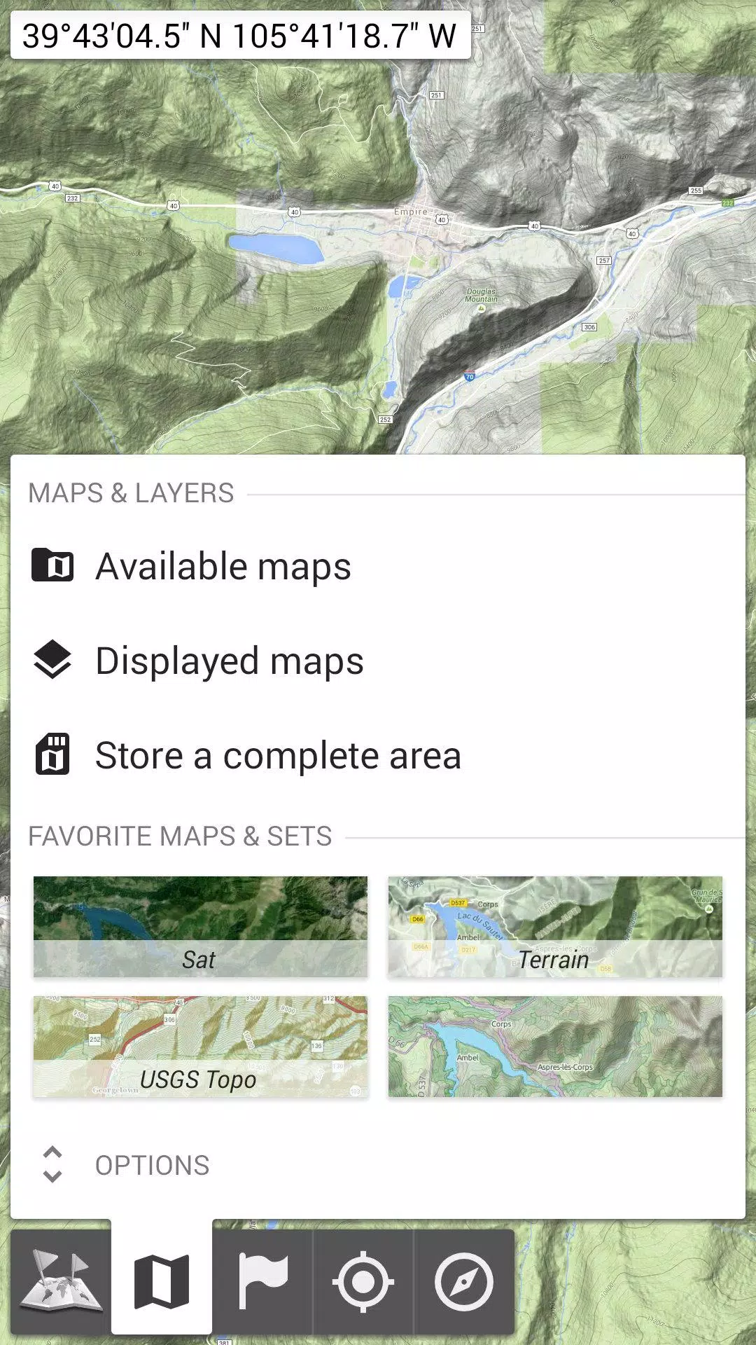
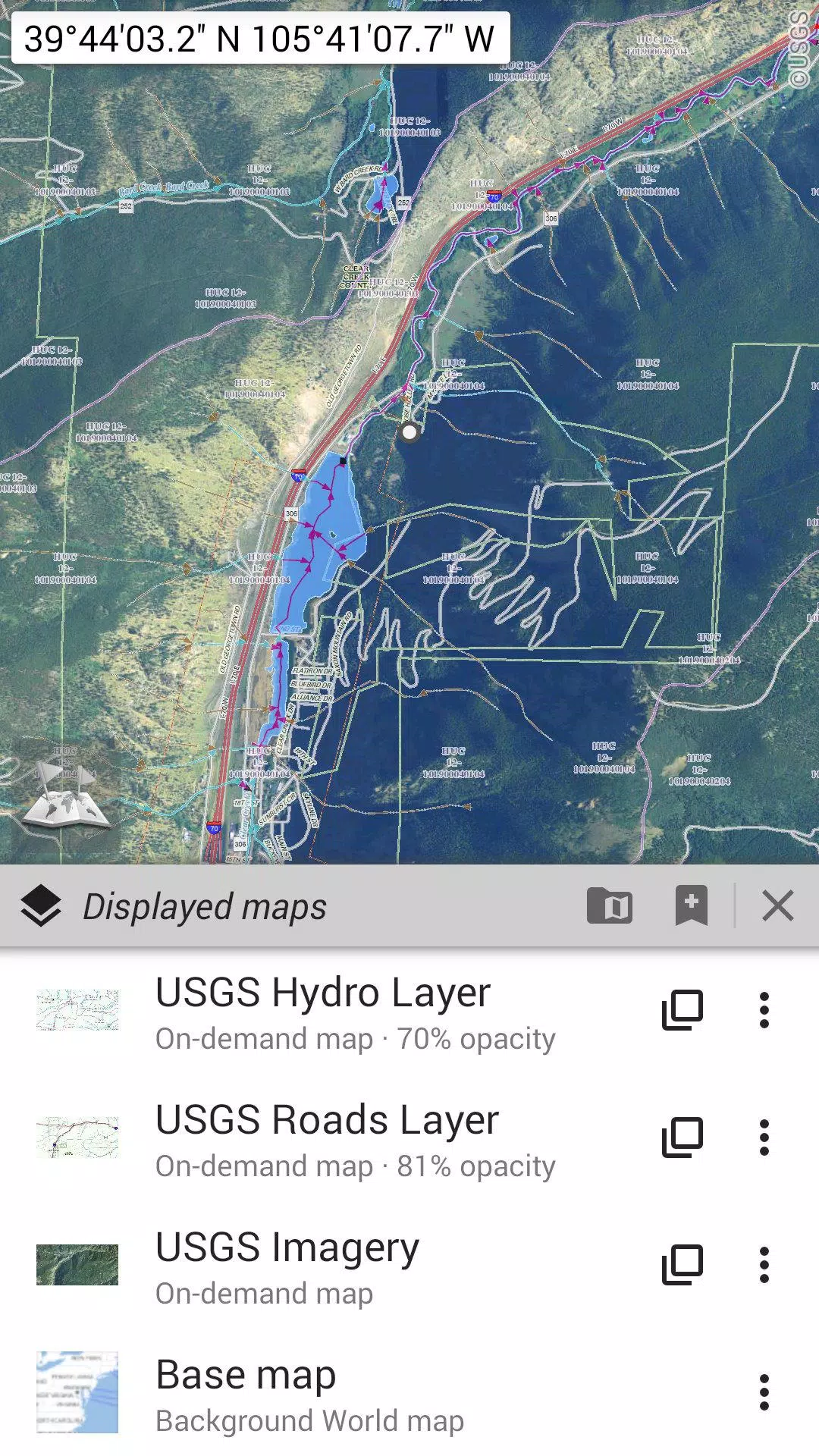
★★ Maps ★★
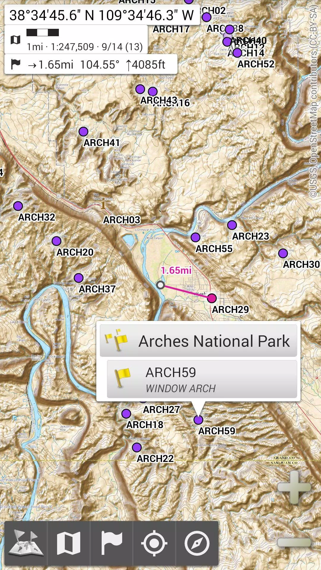
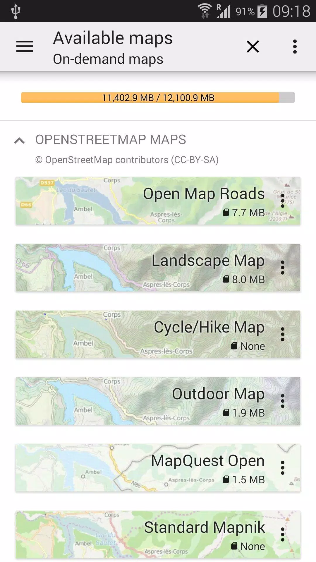
Explore a variety of maps, from classic road maps and topographic maps to aerial (satellite) imagery and additional layers that can be overlaid on any map: OpenStreetMap (Roads, Topo), USGS National Map (Hi-res topo, Aerial imagery), Worldwide Military Soviet topo maps, and more.
• Maps can be layered with precise opacity control;
• Easily select and store large areas with just a few clicks;
• Stored maps are clearly organized and can be deleted effortlessly.
★★ Display, store, and retrieve unlimited placemarks ★★
Add various items to your maps such as waypoints, icons, routes, areas, and tracks.
Effortlessly manage them using the robust SD-Card Placemarks Explorer.
★★ On-map GPS Location & Orientation ★★
Your real-time location and direction are prominently displayed on the map, which can be rotated to align with your actual orientation (depending on your device's capabilities).
Easily turn on/off to conserve battery life.
Plus:
• Options for metric, imperial, and hybrid distance units;
• Support for GPS Latitude/Longitude and multiple grid coordinate formats (UTM, MGRS, USNG, OSGB Grid, Irish Grid, Swiss Grid, Lambert Grids, DFCI Grid, QTH Maidenhead Locator System, ...);
• Import capabilities for numerous coordinate formats from https://www.spatialreference.org;
• On-map grid display;
• Full-screen map view;
• Multi-touch zoom;
• And much more.
★★ Need more? ★★
For true adventurers, dive into AlpineQuest Off-Road Explorer, the ultimate outdoor solution built on All-In-One OfflineMaps, featuring a robust GPS Track Recorder and additional features: https://www.alpinequest.net/google-play
Screenshot
Reviews
Post Comments
Latest Articles
MTG's Edge of Eternities Sold Out at Amazon on Launch
Magic: The Gathering enthusiasts have been counting down to their journey through the Blind Eternities, and the moment has finally arrived. Edge of Eternities officially launched worldwide today, bringing cosmic-scale fantasy to the classic trading c
LEGO Spider-Verse Minifigures Available for Preorder
LEGO is launching an exciting array of new sets this season, but if you're only looking to expand your minifigure collection, the company has a pleasant surprise in store next month. Starting September 1, LEGO will release a blind box of Spider-Man:

Spin Rhythm XD Is Coming to Mobile Soon on the Crunchyroll Game Vault
You may know developer Super Spin Digital for titles like Fruit Ninja, Jetpack Joyride, and Steppy Pants. Another one of their popular releases is the rhythm game Spin Rhythm, whose success paved the way for its sequel, Spin Rhythm XD, which launched

Elden Ring Glitch Eases Item Sharing in Nightreign
Elden Ring Nightreign features some incredible gear drops. There may even be times when you wish to share this equipment with others, while still keeping it for yourself. Fortunately, a gear duplication glitch makes sharing this loot possible, at lea
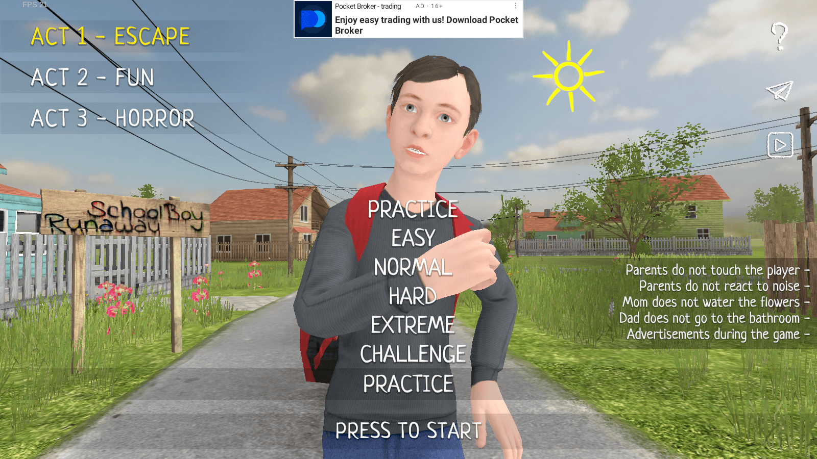
Master Stealth Tactics in SCHOOLBOY RUNAWAY
SCHOOLBOY RUNAWAY – STEALTH delivers thrilling stealth gameplay where you play as a mischievous student who'd rather sneak out than hit the books. Carefully evade your watchful parents using clever tactics and everyday household items to execute your
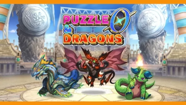
Puzzle & Dragons 0 Launches on Android with Innovative Root Tree System
Puzzle & Dragons 0 is now available, offering a fresh take on matching orbs and defeating monsters. Developed by GungHo Entertainment, the team behind the original mobile hit, this new entry reimagines the beloved puzzle-RPG experience.
What’s New in
Apps like All-In-One Offline Maps


台北捷運Go
Maps & Navigation丨96.5 MB


Crawfisher LE
Maps & Navigation丨33.1 MB

Kigo - Parkimovil
Maps & Navigation丨42.8 MB


BP Fatár
Maps & Navigation丨3.6 MB

GO Sharing
Maps & Navigation丨83.0 MB

Red Taxi
Maps & Navigation丨22.5 MB
Latest Apps

에스크 asked
Communication丨18.30M


Spiga+ AI
Auto & Vehicles丨12.0 MB


Epoxy Resin Art Ideas
Art & Design丨41.0 MB

Lola Casademunt
Shopping丨6.8 MB

Anime Chicken
Tools丨38.90M

WashAssist Dashboard
Lifestyle丨11.70M

Trending Apps
MORE +


Top News
MORE +

01
01-06
CDPR acknowledged weak gameplay in The Witcher 3
The Witcher 3, while critically acclaimed, wasn't without its flaws. Many fans felt the combat system fell short.
In a recent interview, Witcher 4's game director, Sebastian Kalemba, acknowledged weaknesses in the previous game's gameplay, specifically highlighting the need for significant improvem
02
01-07
BREAKING: Flight Simulator 2024 Login Woes Ground Players
Flight Simulator 2024 Launch Plagued by Technical Difficulties
The highly anticipated launch of Flight Simulator 2024 has been significantly hampered by widespread technical problems, leaving many players grounded before they could even take to the virtual skies. This article details the reported d
03
11-17
Hogwarts Legacy 2 is "One of the Biggest Priorities" for WB Games
Following the successful launch of Quidditch Champions this week, Warner Bros. Discovery has confirmed its plans for a sequel to last year's Harry Potter-based action RPG hit Hogwarts Legacy—2023's best-selling game.Hogwarts Legacy Sequel Plans Confirmed by Warner Bros. DiscoveryExpected in
04
11-16
Airplane Chefs Brings The Ultimate Snack, Pringles, On Board!
Buckle up for some snacks as Nordcurrent has just dropped an exciting event for their cooking game. It’s the most unexpected collab of Airplane Chefs and Pringles. If you’ve been enjoying your virtual life as a flight attendant, things are about to get a lot tastier.The game developer behind p
05
11-16
Play Together to collaborate with Sanrio and introduce new My Melody and Kuromi content
Play Together is bringing back its Sanrio collab with the appearance of My Melody and KuromiYou can collect coins by completing their themed missions that can then be used to draw exclusive itemsAs a bonus there's also new summer-themed content and events, including a major bug huntPlay Together, th
Topics
More +