Application Description
Stay on top of severe weather events with Zoom Earth, the ultimate interactive weather map and real-time hurricane tracker. This powerful tool provides a comprehensive suite of features, including satellite imagery, rain radar, weather forecast maps, hurricane tracking, wildfire tracking, and a host of customization options to tailor your experience.
With Zoom Earth, you can access near real-time satellite imagery sourced from leading providers like NOAA GOES, JMA Himawari, EUMETSAT Meteosat, and NASA's Aqua and Terra polar-orbiting satellites. This ensures you have the most up-to-date visuals of weather patterns across the globe.
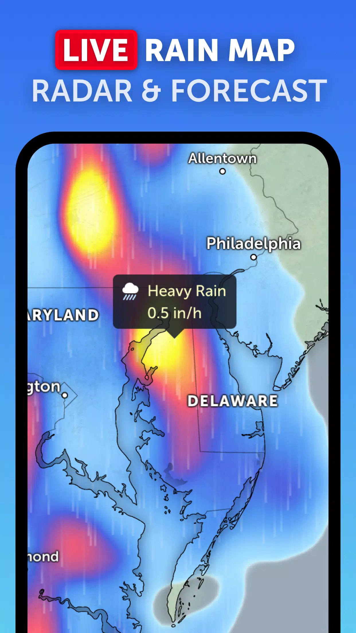
Stay ahead of the storm with our advanced rain radar, which displays real-time rain and snow detected by ground-based Doppler radar. This feature is crucial for tracking the movement and intensity of precipitation, helping you prepare for incoming weather systems.
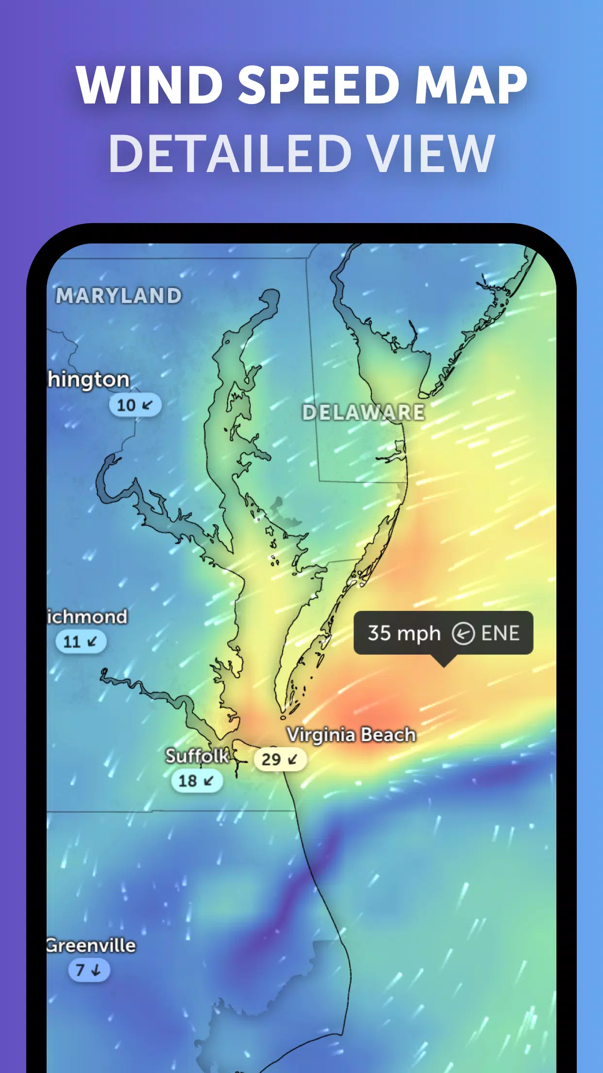
Explore our stunning, interactive weather forecast maps that offer detailed visualizations of various weather parameters. From precipitation and wind speed to temperature, "feels like" temperature, relative humidity, dew point, and atmospheric pressure, these maps provide a comprehensive view of future weather conditions.
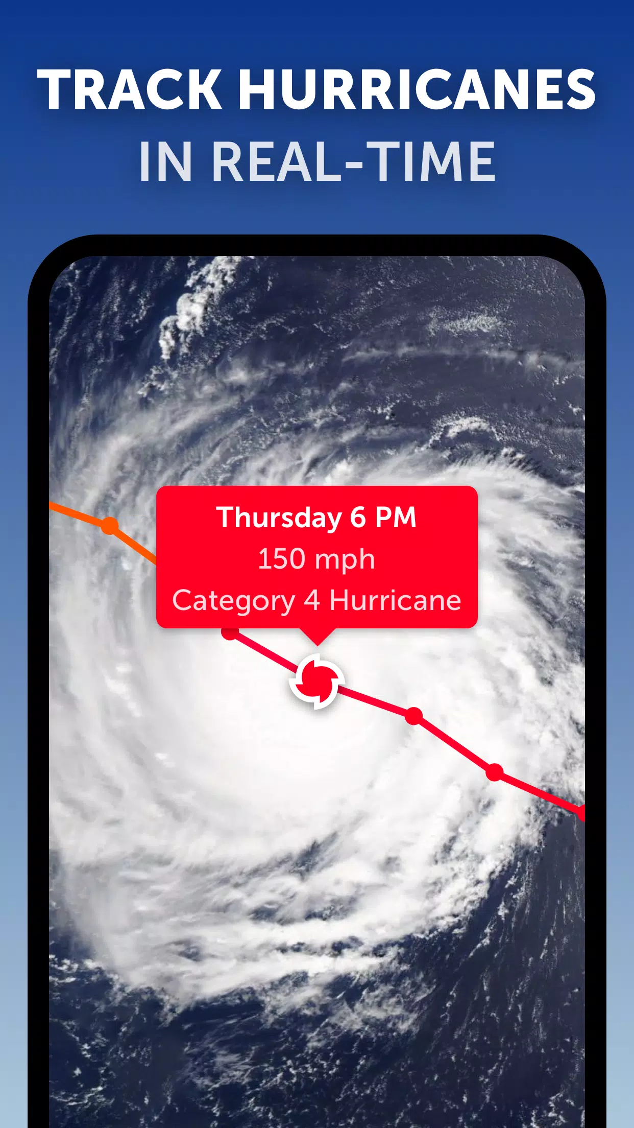
When it comes to tracking hurricanes, Zoom Earth stands out with its best-in-class tropical tracking system. Follow the development of hurricanes from their inception to category 5 status in real-time, using the latest data from the National Hurricane Center (NHC), Joint Typhoon Warning Center (JTWC), Naval Research Laboratory (NRL), and the International Best Track Archive for Climate Stewardship (IBTrACS).
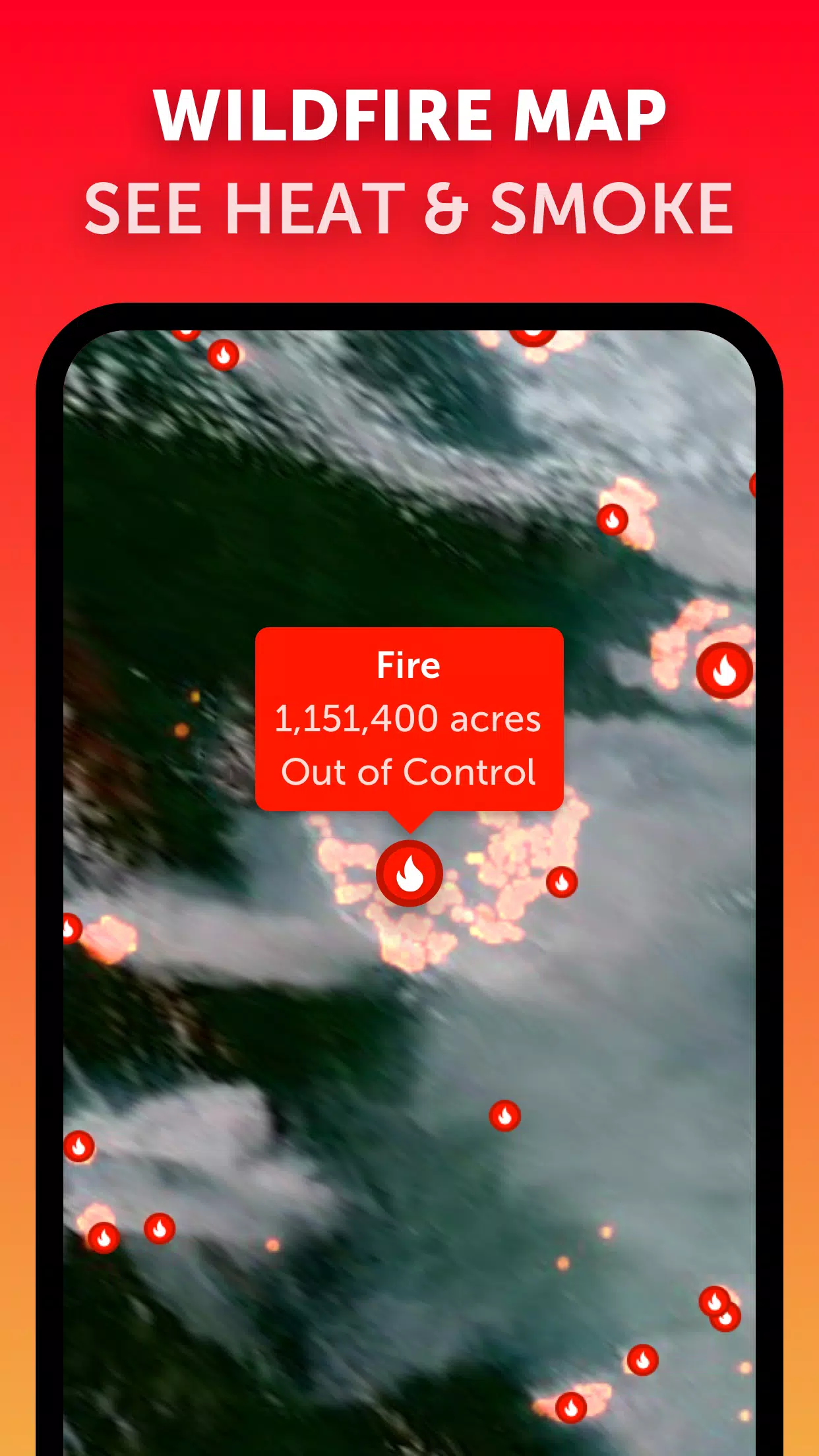
Additionally, monitor wildfires with our active fires and heat spots overlay, which uses daily updates from NASA's Fire Information for Resource Management System (FIRMS) to show points of very high temperature detected by satellite.
Customize your experience with Zoom Earth by adjusting temperature units, wind units, time zone, animation styles, and more through our comprehensive settings. This ensures that you can tailor the tool to meet your specific needs and preferences.
What's New in the Latest Version 3.1
Last updated on Sep 19, 2024
- Reduced clutter when viewing multiple tropical systems.
- Separate alerts for Atlantic and Eastern Pacific systems.
- Improvements to map labels.
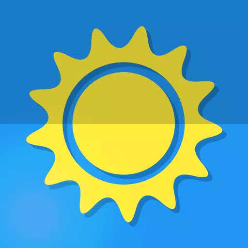
Screenshot
Reviews
Post Comments
Latest Articles
Goblin Valley: Cozy Home Game Opens Pre-Registration
Build and expand your thriving goblin farm villageInteract with quirky goblins, each with unique personalitiesMonitor and fulfill your goblin residents' needsUnimob Global has recently launched pre-registrations for Idle Goblin Valley: Chill Farm, of

Heartopia is kicking off its first closed beta test next month
The initial CBT runs from November 4th through the 18thEngage in hobbies such as fishing, birdwatching, and cookingAdopt pets, customize your home interior, and design unique outfitsHeartopia, XD Games’ highly anticipated life simulation title announ

Summoners War set to host collaboration with the iconic fantasy book series The Lord of the Rings
Summoners War: Sky Arena has teamed up with none other than The Lord of the Rings.
Set to launch later this month, the collaboration brings iconic characters from the Fellowship and beyond into the game.
The Lord of the Rings needs no introduction—it
Another Eden expands its Chrono Cross collaboration content with Glenn and new story
Another Eden is introducing fresh content to its existing Chrono Cross collaboration materialThe release includes a beloved character named Glenn from The Cursed DragoonA new character and upcoming events are also being added to honor Japan Cat DayAl

The $13 FrSara Portable Neck Fan Is an Inexpensive Solution to Beating the Summer Heat
Summer has arrived, and neck fans are seeing a surge in popularity. These portable fans offer a simple, effective, and affordable way to stay cool and comfortable. Amazon is currently offering 50% off the FrSara Rechargeable Portable Neck Fan with th
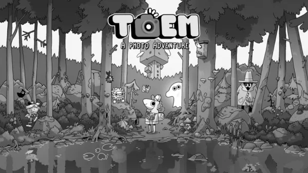
Hand-Drawn Photography Adventure Game TOEM Opens Pre-Registration on Mobile
BAFTA-winning title TOEM: A Photo Adventure arrives on mobile devices worldwide.
Developed by Swedish indie studio Something We Made, pre-registration for TOEM is now available on Android. The official release date is set for October 22nd.
Fun fact:
Apps like Zoom Earth
Meteoprog - Weather forecast
Weather丨28.0 MB

My Moon Phase
Weather丨43.9 MB
Rain Today
Weather丨97.3 MB

Rome Weather Forecast
Weather丨28.4 MB

Buienradar
Weather丨65.4 MB
WDTN Weather
Weather丨51.7 MB
Weatherzone
Weather丨92.6 MB

Latest Apps


Epoxy Resin Art Ideas
Art & Design丨41.0 MB

Lola Casademunt
Shopping丨6.8 MB

Anime Chicken
Tools丨38.90M

WashAssist Dashboard
Lifestyle丨11.70M


FUNNY PICKUP LINES
Lifestyle丨7.10M

HANGOVER VPN
Tools丨29.10M
Trending Apps
MORE +


Top News
MORE +

01
01-06
CDPR acknowledged weak gameplay in The Witcher 3
The Witcher 3, while critically acclaimed, wasn't without its flaws. Many fans felt the combat system fell short.
In a recent interview, Witcher 4's game director, Sebastian Kalemba, acknowledged weaknesses in the previous game's gameplay, specifically highlighting the need for significant improvem
02
01-07
BREAKING: Flight Simulator 2024 Login Woes Ground Players
Flight Simulator 2024 Launch Plagued by Technical Difficulties
The highly anticipated launch of Flight Simulator 2024 has been significantly hampered by widespread technical problems, leaving many players grounded before they could even take to the virtual skies. This article details the reported d
03
11-17
Hogwarts Legacy 2 is "One of the Biggest Priorities" for WB Games
Following the successful launch of Quidditch Champions this week, Warner Bros. Discovery has confirmed its plans for a sequel to last year's Harry Potter-based action RPG hit Hogwarts Legacy—2023's best-selling game.Hogwarts Legacy Sequel Plans Confirmed by Warner Bros. DiscoveryExpected in
04
11-16
Airplane Chefs Brings The Ultimate Snack, Pringles, On Board!
Buckle up for some snacks as Nordcurrent has just dropped an exciting event for their cooking game. It’s the most unexpected collab of Airplane Chefs and Pringles. If you’ve been enjoying your virtual life as a flight attendant, things are about to get a lot tastier.The game developer behind p
05
11-16
Play Together to collaborate with Sanrio and introduce new My Melody and Kuromi content
Play Together is bringing back its Sanrio collab with the appearance of My Melody and KuromiYou can collect coins by completing their themed missions that can then be used to draw exclusive itemsAs a bonus there's also new summer-themed content and events, including a major bug huntPlay Together, th
Topics
More +